I thought this was interesting.
Water is going to be a very big problem at some point in our history as humans. If it’s not already.
I had not seen a map like this before. The USGS put out a cool map with data on the USA aquifers. Click on the map for the PDF file that explains what the map means.
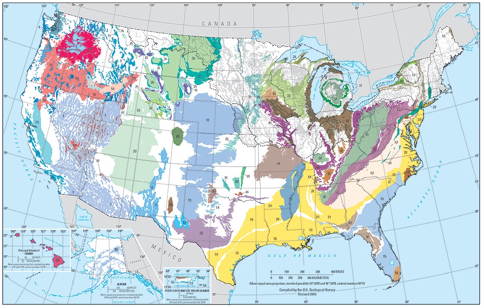
The areal and vertical location of the major aquifers is fundamental to the determination of groundwater availability for the Nation. An aquifer is a geologic formation, a group of formations, or a part of a formation that contains sufficient saturated permeable material to yield significant quantities of water to wells and springs.
A two-dimensional map representation of the principal aquifers of the Nation is shown below. The map, which is derived from the Ground Water Atlas of the United States, indicates the areal extent of the uppermost principal aquifers on a national scale. In this map, a principal aquifer is defined as a regionally extensive aquifer or aquifer system that has the potential to be used as a source of potable water. (For study or mapping purposes, aquifers are often combined into aquifer systems.)
More information on the USGS web page here. The book Water 4.0 is a good read on this topic.